


Khao Chang Phuek - Thong Pha Phum National Park
เขาช้างเผือก อุทยานแห่งชาติทองผาภูมิ
เขาช้างเผือก อุทยานแห่งชาติทองผาภูมิ
Khao Chang Phuek - Thong Pha Phum National Park
(เขาช้างเผือก อุทยานแห่งชาติทองผาภูมิ)
Kanchanaburi
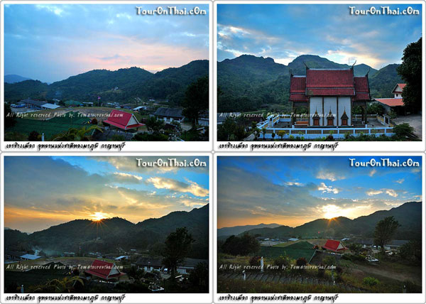
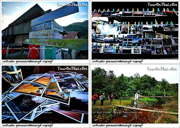
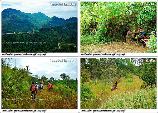
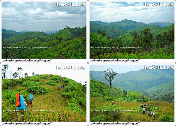
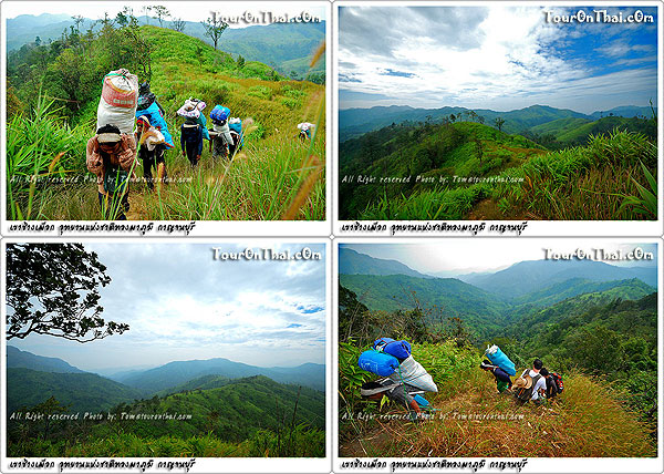
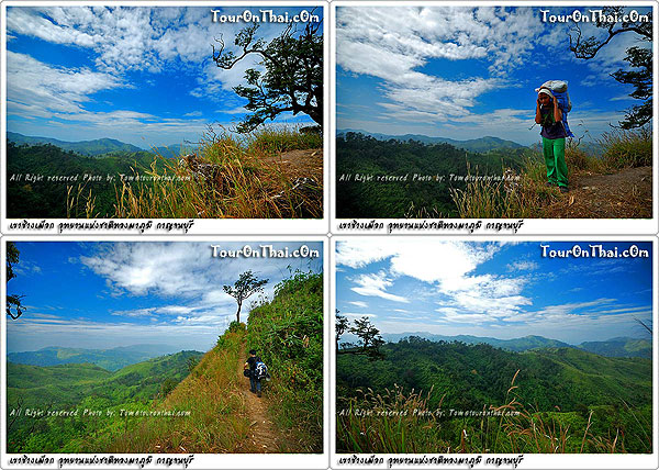
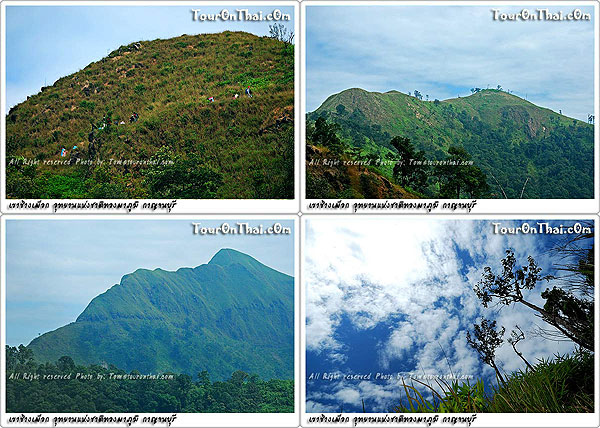
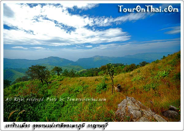
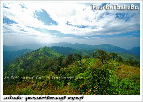
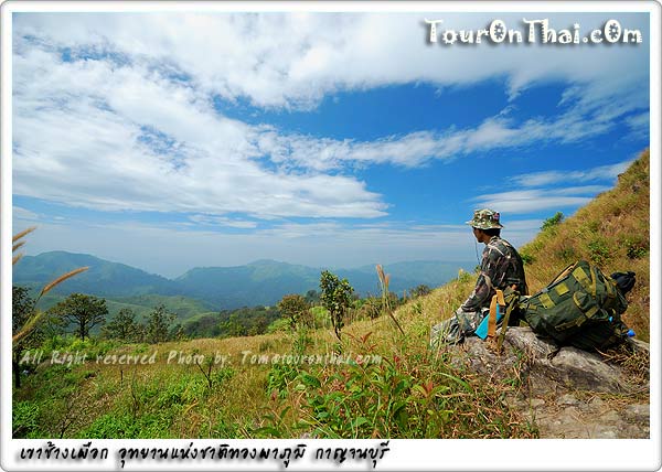
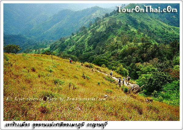
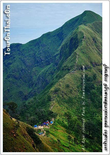
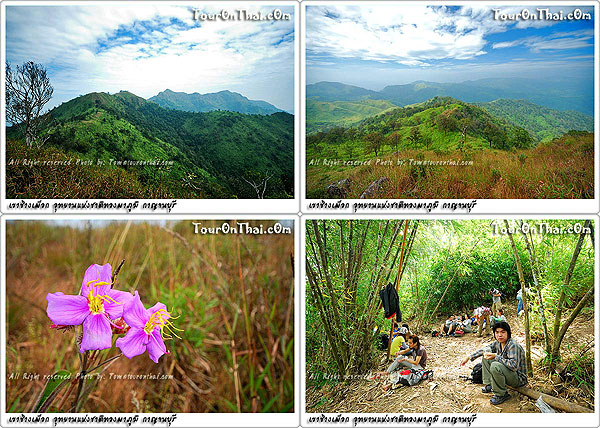
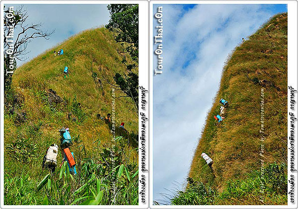
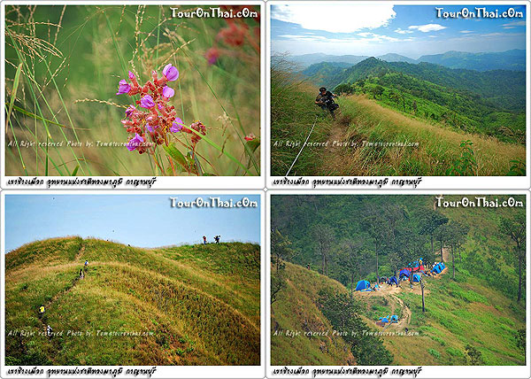
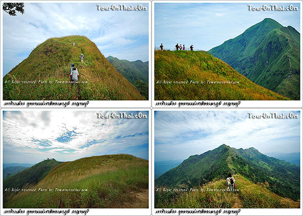
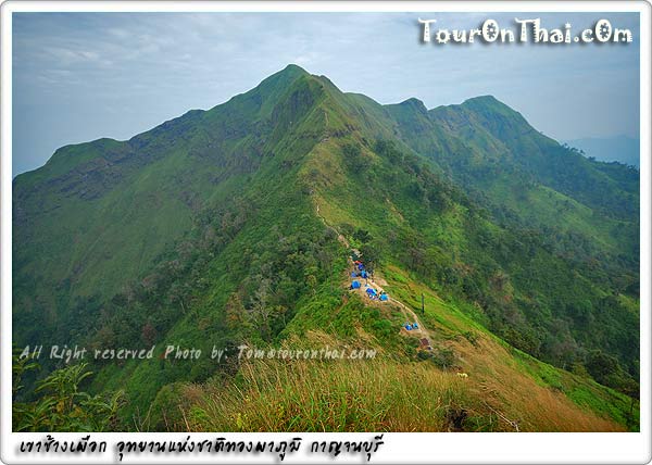
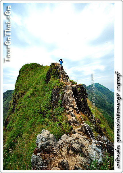
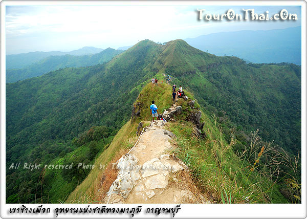
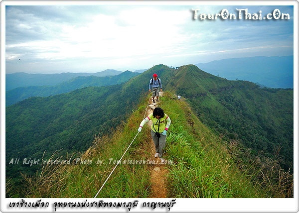
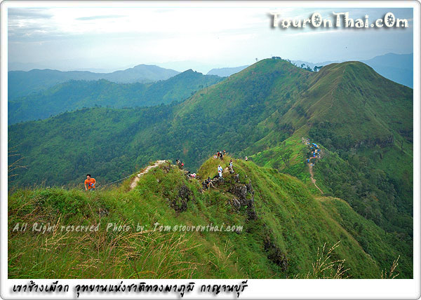
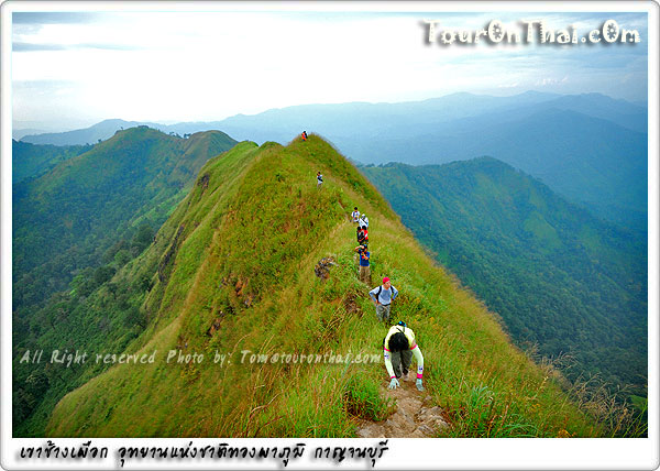
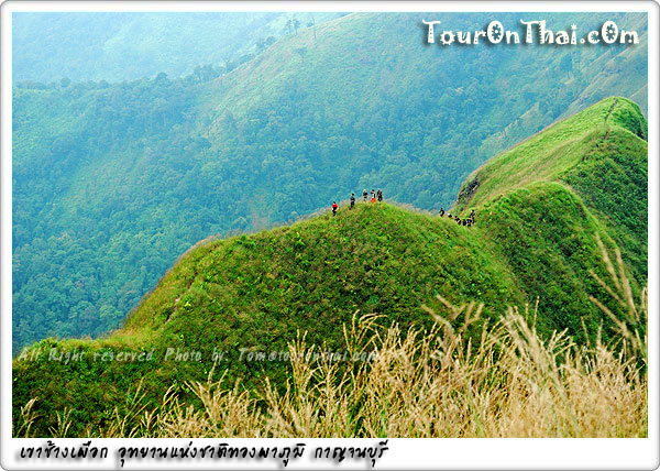
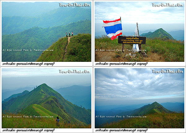
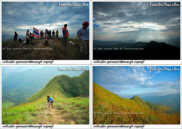
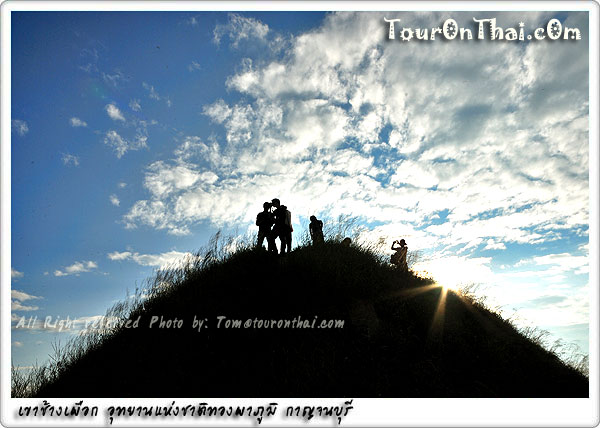
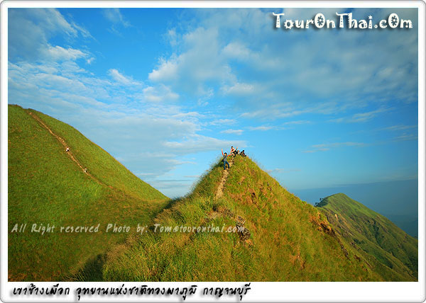
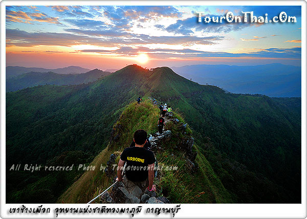
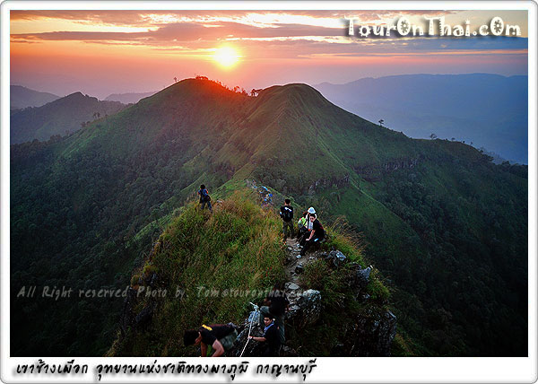
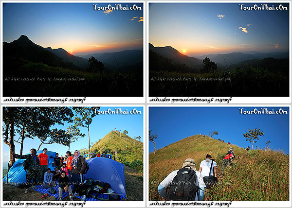
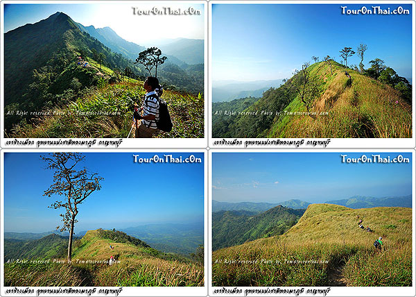
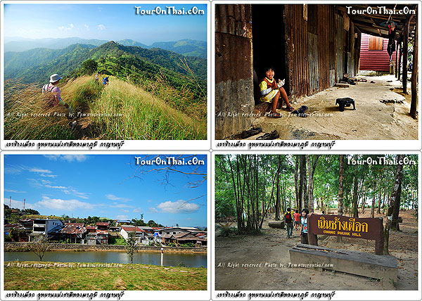
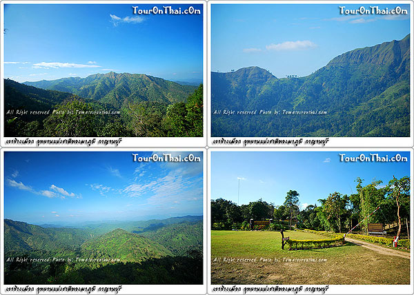
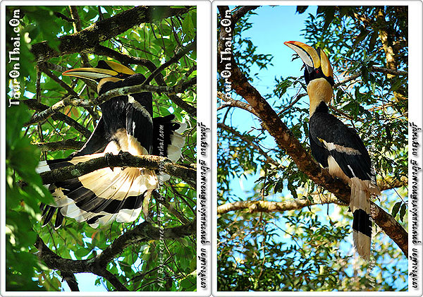
Thong Pha Phum National Park, Located within the area of Pa Huai Khayeng and Pa Khao Chang Phueak reserved forests covering a total area of approximately 700,000 rai, some 60 km. to the west of Amphoe Thong Pha Phum on Highway 3272. There are many spots of interest including 2 viewpoints at Doi Tong Palae which is about 300 metres uphill from where Namtok Chokkadin is visible, and Noen Kut Doi which is accessible by car and offers a panoramic view of the mountains, Vajiralongkorn Dam and Khao Chang Phueak – the national park’s highest peak. There are 3 nature trails to waterfalls; namely, Namtok Chokkadin, Namtok Pha Pae and Namtok Chet Mit. These waterfalls are located in the evergreen forest of Tambon Pilok which is a former location of tin and wolfram mines on the Thai – Burmese border. A four-wheel drive car and hired guide will be needed.
Getting there: Use Highway 323 to Amphoe Thong Pha Phum and turn into Highway 3272 (Thong Pha Phum – Pilok Mine) for some 57 km. to Thong Pha Phum National Park’s headquarters. The road, though asphalted, climbs up the mountain with several sharp curves; drivers will have to drive carefully.
Khao Chang Phuek nature trail is open in a limit of time please check with the National Park officer before planning a trip.
Accommodation and camping ground is available. Admission is Bt400 for adults and Bt200 for children. For further details, please call Tel. 08 1382 0359, 0 3453 2114 or Thong Pha Phum National Park, P.O. Box 18, Amphoe Thong Pha Phum, Kanchanaburi 21110.
(เขาช้างเผือก อุทยานแห่งชาติทองผาภูมิ)
Kanchanaburi
Thong Pha Phum National Park, Located within the area of Pa Huai Khayeng and Pa Khao Chang Phueak reserved forests covering a total area of approximately 700,000 rai, some 60 km. to the west of Amphoe Thong Pha Phum on Highway 3272. There are many spots of interest including 2 viewpoints at Doi Tong Palae which is about 300 metres uphill from where Namtok Chokkadin is visible, and Noen Kut Doi which is accessible by car and offers a panoramic view of the mountains, Vajiralongkorn Dam and Khao Chang Phueak – the national park’s highest peak. There are 3 nature trails to waterfalls; namely, Namtok Chokkadin, Namtok Pha Pae and Namtok Chet Mit. These waterfalls are located in the evergreen forest of Tambon Pilok which is a former location of tin and wolfram mines on the Thai – Burmese border. A four-wheel drive car and hired guide will be needed.
Getting there: Use Highway 323 to Amphoe Thong Pha Phum and turn into Highway 3272 (Thong Pha Phum – Pilok Mine) for some 57 km. to Thong Pha Phum National Park’s headquarters. The road, though asphalted, climbs up the mountain with several sharp curves; drivers will have to drive carefully.
Khao Chang Phuek nature trail is open in a limit of time please check with the National Park officer before planning a trip.
Accommodation and camping ground is available. Admission is Bt400 for adults and Bt200 for children. For further details, please call Tel. 08 1382 0359, 0 3453 2114 or Thong Pha Phum National Park, P.O. Box 18, Amphoe Thong Pha Phum, Kanchanaburi 21110.
 |
0/0 จาก 0 รีวิว |

click for map of Khao Chang Phuek - Thong Pha Phum National Park
Hotels near by Khao Chang Phuek - Thong Pha Phum National Park
(เขาช้างเผือก อุทยานแห่งชาติทองผาภูมิ)
*note the distance is not an accurate transition on the road
Attractions near by Khao Chang Phuek - Thong Pha Phum National Park
(เขาช้างเผือก อุทยานแห่งชาติทองผาภูมิ)
*note the distance is not an accurate transition on the road
Foods&Drinks near by Khao Chang Phuek - Thong Pha Phum National Park
(เขาช้างเผือก อุทยานแห่งชาติทองผาภูมิ)
*we're collecting information*
send your favorite place click..
*note the distance is not an accurate transition on the road